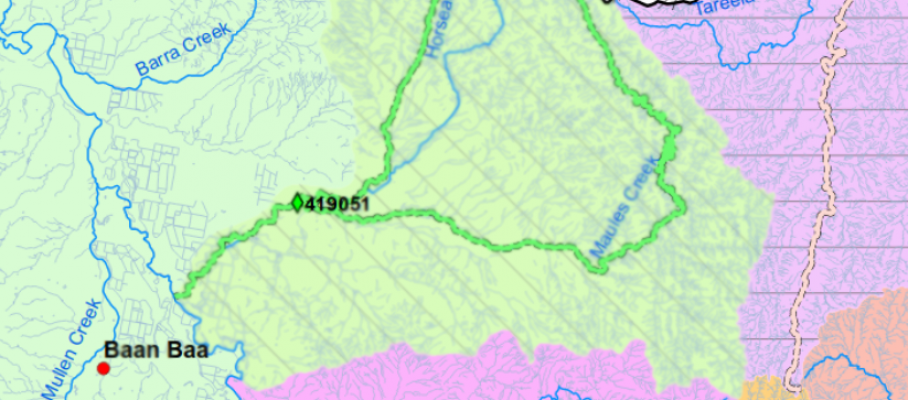
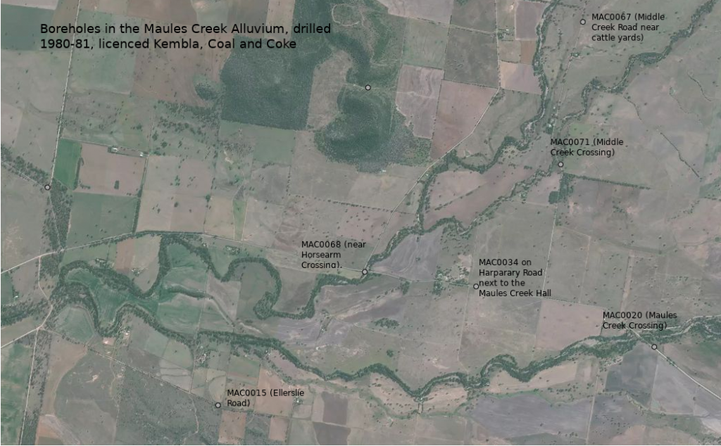
Apr 27 2018
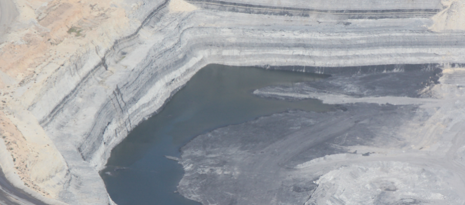
Aerial photos of Maules Creek mine pit lake
The above aerial photo from the 14.4.2018 with the 300 tonne dump truck in the foreground shows the sheer amount of water in the Maules Creek mine pit. It’s deeply concerning given that the Tarrawonga and Boggabri coal mines are both dry and that the original EIS modelling estimated only 36 ML of groundwater would have flowed into the Maules Creek coal pit over the last 12 months.
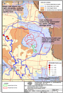
Without transparent data to the contrary, this raises the significant prospect of connectivity of the coal seams to the Maules Creek alluvial aquifer.
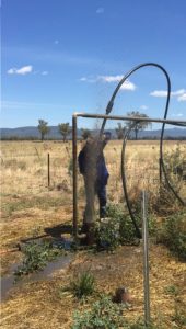
De-watering Pump
In order to drill, blast and excavate the coal, the mine is systematically de-watering the coal seams.
The de-watering pump in the Maules Creek coal mine can be seen in this short video. According to the 2014 Water Management Plan the discharge from this pump ends up in the Mine Water Dam to be used for dust suppression.
The question for local people is – is the mine only de-watering the coal seams?
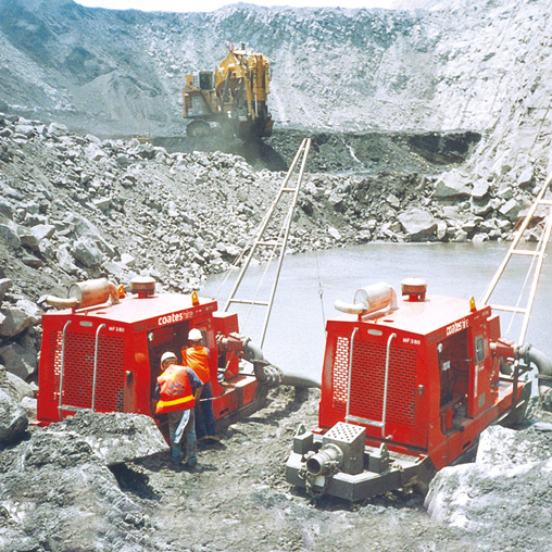
One 100 mm pump such as those shown here could move a lot of water if operated 24 x 7, 365 days per year. A 150 mm pump could move much more.
With pit pumping conditions similar to those at the Maules Creek coal mine (70 m head and 800 m of lay flat hose), according to suppliers, a 100 mm pump could lift 30 – 50 litres per second, 2.5 – 4.0 ML per day or 946 – 1,575 ML per year.
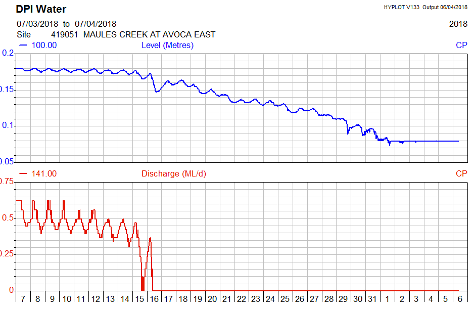
The last few months have been dry (with approx 40% of average rainfall)1 and the full pumping capacity should not be needed at the Maules Creek coal mine to manage pit inflows.
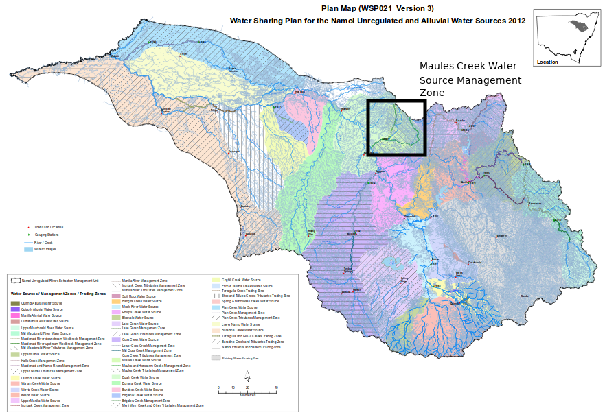
Groundwater Modelling
The groundwater consultants (AGE) estimated in the Groundwater Impact Assessment very minor pit inflows or “seepage” when they simulated over 30 years the average groundwater inflows to the Maules Creek and adjacent mines.
Year 1 – 5 estimates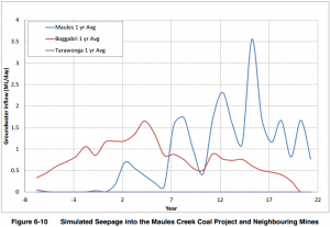
- Year 5 – 0.2 ML per day *
- Year 10 – 1.2 ML per day
- Year 15 – 2.9 ML per day
- Year 21 – 0.7 ML per day
(See Fig 6.10 Maules Creek coal mine Water Management Plan.)
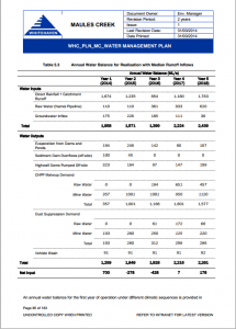 AGE’s 2014 modelling predicts the average annual loss of recharge to the alluvium due to seepage into the Maules Creek coal mine is a mere 50 ML/year. Even less in year 5. In fact the Water Balance model of the mines water usage shows a decline in groundwater inflow over the first 5 years to just 36 ML in year 5.
However given the current dry patch, the lack of runoff and the significant volume of water in the pit, how realistic is the AGE estimate of 36 ML “seepage”?
Anecdotal evidence is that this pump has been running for much longer than 1 hour per day over the last 14 months. If true, this would indicate a substantial variation from what the State Government has approved. Without any transparent data to the contrary it is time for the regulators to act.
Regulation
The estimated pit inflows to the Maules Creek mine are the basis for the monitoring and the Adaptive Management requirements of the project approval. If monitoring of the groundwater inflow shows adverse groundwater impacts then this should trigger a management response as required by the 2014 Water Management Plan section 6.3.4;
“Should monitoring results be outside of the predictions made within the Groundwater Impact Assessment (as summarised above) and indicate a substantial variation beyond the trigger levels presented, then an investigation into the data will be implemented to confirm the reason for the variation and to implement the relevant actions. The process of investigation that will be implemented is described further in Section 7.0.”
This ties vaguely to Schedule 5 of the project approval which requires notification within 7 days;
“Incident Reporting
Schedule 3 Section 40 of the project approval referrd to in the Adaptive Management section of Schedule 5 says;
- a program to monitor and assess:
- groundwater inflows to the open cut mining operations;
- the seepage/leachate from water storages, emplacements, backfilled voids and the final void;
- interconnectivity between the alluvial and bedrock aquifers;
- background changes in groundwater yield/quality against mine-induced changes;
- the impacts of the project on:
- regional and local (including alluvial) aquifers;
- groundwater supply of potentially affected landowners;
- groundwater dependent ecosystems (including potential impacts on stygo-fauna and Melaleuca riparian forest communities)and riparian vegetation;
- a program to validate the groundwater model for the project, including an independent review of the model every 3 years, and comparison of monitoring results with modelled predictions; and
- a plan to respond to any exceedances of the performance criteria;


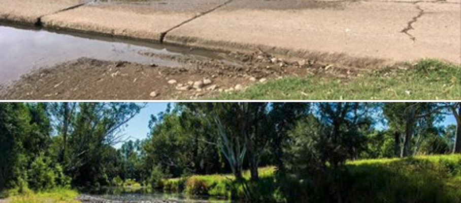
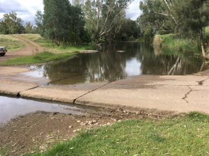


May 15 2018
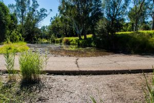
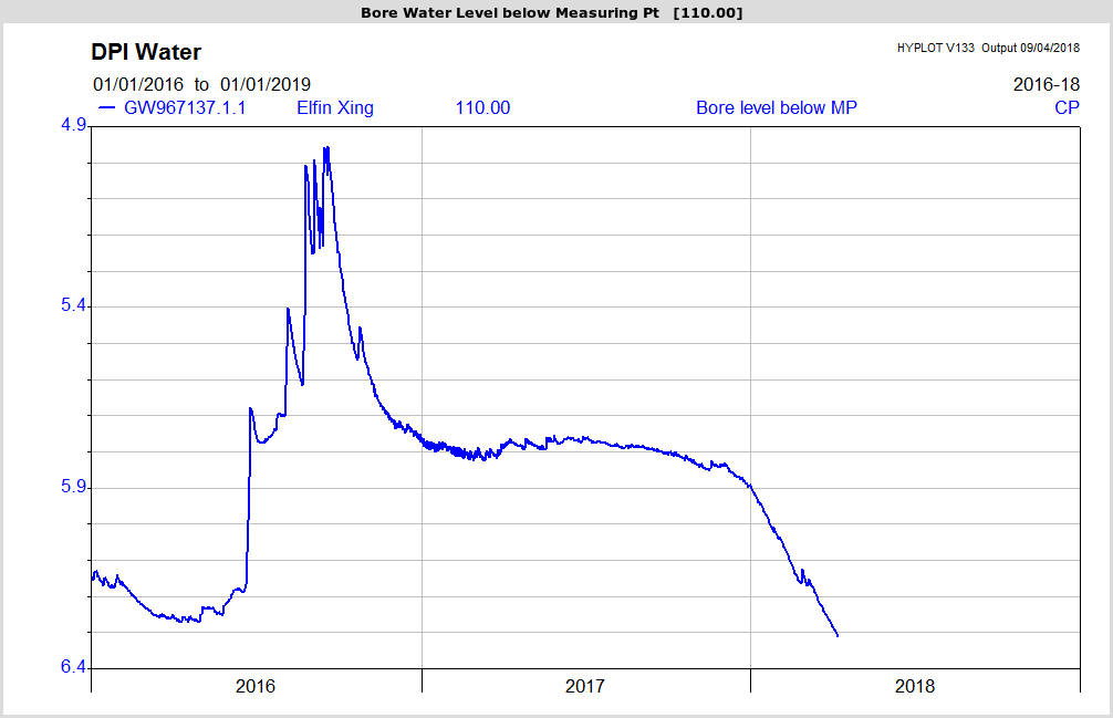
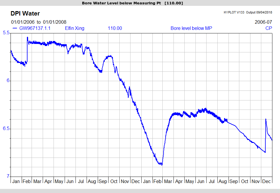
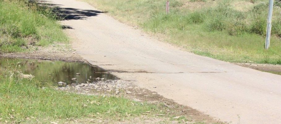
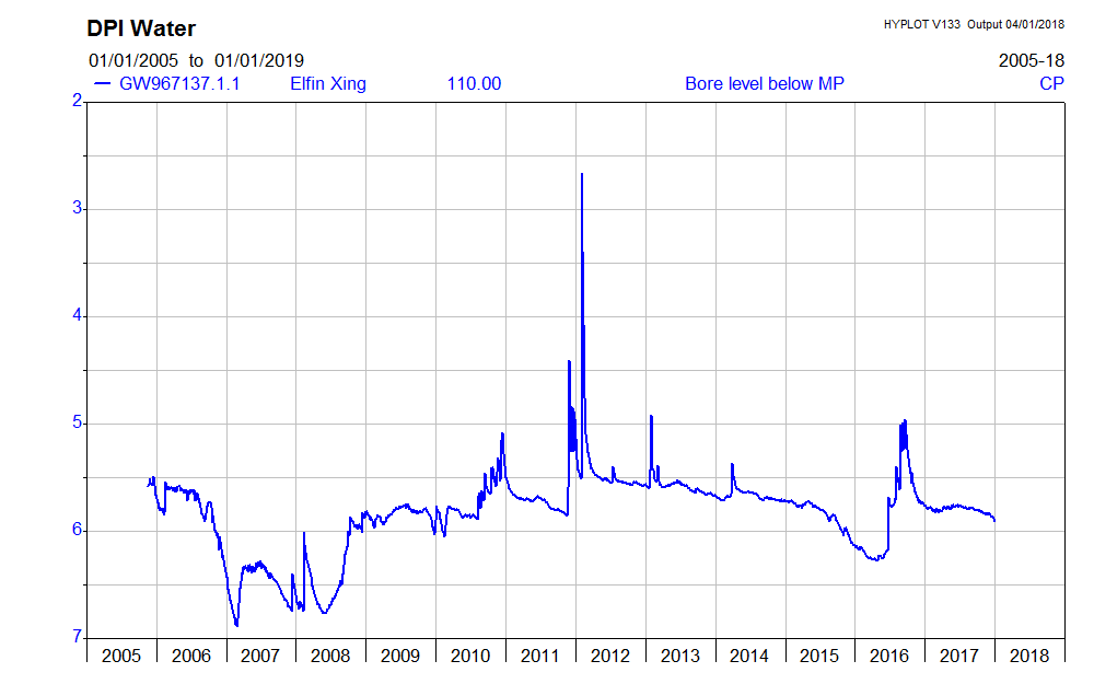
Photographic evidence of the water decline at Elfin Crossing
By MCCC • Uncategorized •